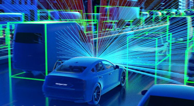
Everyone has heard of RADAR technology, but have you heard of LiDAR? The two are similar, but RADAR uses radio waves to measure variable distances, whereas LiDAR (Light Detection and Ranging) uses light in a pulsed laser to measure varying distances. LiDAR is especially useful in surveying operations for ‘laser scanning’ and producing 3D point cloud images.
Working Mechanism of LiDAR Sensors
A typical LiDAR sensor sends out pulsed light waves into its surroundings. These pulses reflect off nearby objects and return to the sensor. The sensor calculates the distance traveled by using the time it takes for each pulse to return to the sensor. This process, repeated millions of times per second, produces a precise, real-time 3D map of the environment. An onboard computer can use this map to ensure safe navigation.
How do lidar Sensors differ from camera systems?
Cameras generate two-dimensional images of their surroundings. Lidar “sees” in three dimensions, which is a considerable advantage when accuracy and precision are critical. The laser-based technology generates real-time, high-resolution 3D maps, or point clouds, of the environment, demonstrating a level of distance accuracy unrivaled by cameras, even those with stereo vision. Whereas cameras must make assumptions about the distance to an object, lidar produces and provides precise measurements. As a result, lidar is required for safe navigation in autonomous or highly automated systems. The ability to “see” in three dimensions cannot be overstated. Lidar generates millions of data points at close to the speed of light. Each point accurately measures the surrounding environment—Lidar’s ability to “see” in contrast to camera systems.
Environmental conditions (e.g., bright sunlight/glare and darkness) also significantly impact camera performance, making it more susceptible to unpredictable blind spots and false positives or negatives. Whereas cameras rely on ambient light and struggle with darkness and glare, lidar has its light source and can thus “see” in all lighting conditions.
Lidar has a technological advantage over camera systems in that it enables the vehicle’s computer to “see” the driving environment from an overhead, bird’s eye perspective. As a result, the car can navigate from the perspective of a traditional driver and the perspective of a bird flying overhead, similar to the views available in many video games. Thus, lidar “sees” more comprehensively than a person, looking down on all sides of the car, road, and traffic simultaneously.
A lidar-centric autonomous system is required for accuracy and safety. This means that lidar is the primary sensor, and you can add small, low-cost cameras to the system for redundancy and extra protection.
Uses of LiDAR Sensors
- Surveying of Land
LiDAR sensors can be attached to drones to generate quickly, accurately, and cost-effectively rate 3D digital terrain models (DTM) of remote or rough areas. As a result, UAVs are ideal devices for covering specific land areas where manned aircraft would be overkill. In addition, drones are less expensive and quicker to deploy than planes or helicopters, lowering costs and risk.
- Applications for Mining
LiDAR proves to be an excellent tool for calculating material volumes in open-pit mines without interfering with work on the ground. Integrating drones into mining workflows cuts time, costs, and risk exposure.
- Forestry and Agriculture
Drones have LiDAR sensors to survey large farms to determine how to use resources to increase productivity. You can also use it to create 3D models of the impact of human activity on forest areas. One significant advantage of LiDAR is its ability to penetrate tree cover.
- Inspection of Power Lines for Maintenance
Power line maintenance poses significant safety risks. LiDAR technology can detect problems in power lines before they become a problem. Utility companies can quickly assess the damage with UAVs and devise a solution with the lowest level of risk.
- Expansion of Transportation
LiDAR technology is a powerful tool that city planners can use to help expand mass transit systems and rail stations. UAVs equipped withLiDAR sensors can scan large areas and generate valuable data to plan future transportation infrastructure. They can sense small objects on the road, including low reflectivity objects.
In conclusion, A LiDAR system estimates the heights of objects on the ground by using a laser, GPS, and an IMU. Waveforms are used to generate discrete LiDAR data, with each point representing a peak energy point and the returned energy.
Discrete LiDAR points have x, y, and z values. Height is calculated using the z value.
You can use various methods of LiDAR data to estimate tree height and even canopy cover.


